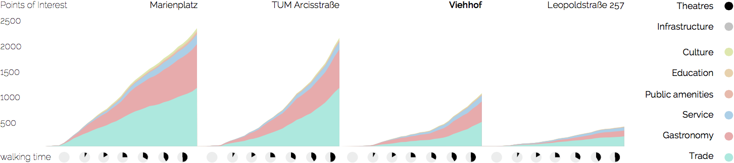
Points of Interest
A series of maps produced from Open Street Map point of interest data. From the function over the distance from a certain point displaying the cumulative number of amenities, different types of places can be identified. This curve alone inherits information about a place's location on multiple scales: Its relationship to the city center, to the closest sub-centers, the next busy street, and the types and intensities of different functions in its direct environment. The "Viehhof" area that was of interest in this analysis was unique in the 'emptiness' of its direct environment compared to its closeness to the city center.